


Where Salmon Bay Meets Shilshole Bay, Pre-Locks to Present
Explore how the entry into Seattle’s Salmon Bay has changed over time, with a side-by-side look at past and present.

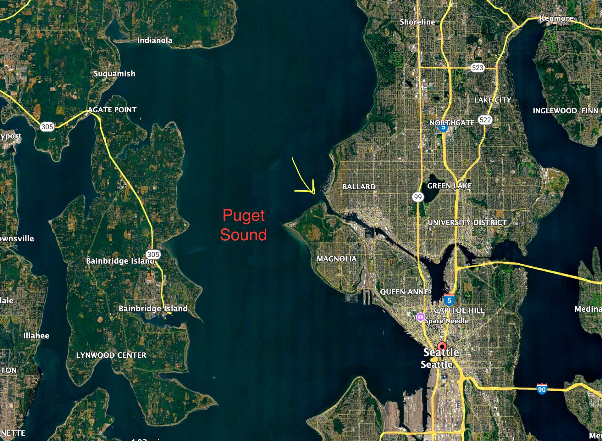
This post continues from from my prior post instead focusing more on the entry to Salmon Bay from Shilshole Bay.
Located in the Ballard neighborhood of Seattle, Salmon Bay empties the lakes above into Puget Sound at Shilshole Bay.
Since time immemorial the Shilshole or šilšul (or Shilshoolabsh) people lived on upper Salmon Bay above the current location of the Locks.
As lushootseed speaking people the endonym is šilšulabš, means "people of šilšul" or "needle-threading people" referring to the narrow entrance into Salmon Bay which was only accessible at higher tides. Read more here
Before the Ballard Locks opened in 1917 this channel was low enough at low tides thus allowing people to walk across. Canoes then later ships had to wait for the flood tide to fill the entry to enter at higher tides.
Here's a chart from the Wilkes Expedition of 1841 of the same area showing sand bars and the undeveloped shoreline of Salmon and Shilshole Bays, (lower right).
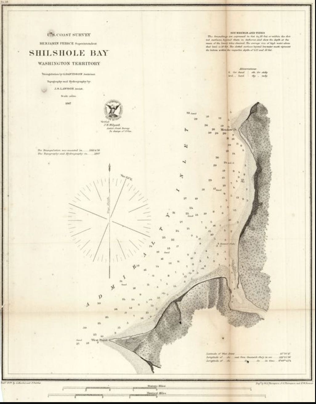
Before dredging for the Ballard Locks ship canal in 1915, a large sandbar seen in both the Wilkes chart and photo below here show how shallow it was at low tide. The šilšul people called it 'Hanging on the Shoulder' or KeehLalabud.' The sandbar was known for good clamming.
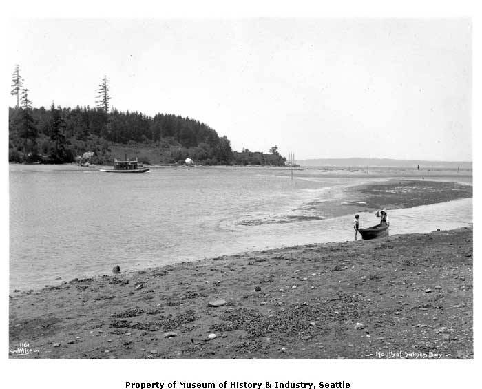
This view below is taken from the Ballard side just south of Ray’s Boathouse and ajacent to the former Golden Tides restaurant then later Azteca looking west towards the northern tip of Magnolia. Note the ship masts in the distance, probably waiting for a higher tide to access logging mills inside the bay.
This March 2022 photo below shows my surf ski parked on the Ballard side below Seaview Ave. The tide is a touch higher than the historic photo.
Despite the sandbars being removed the Locks always have current flowing out, often stronger after heavy rains or during the spring during snow melt. As a paddle coach here I show my students how to use eddies to move up stream then take the current back down.

Resources:
The above native terms were taken from Coll Thrush's 'Native Seattle' book by UW Press.
Read also Paul Dorpat's post on this spot Here
And Jennifer Ott’s and David William's book by History Link: 'Waterway' on the history of Seattle's Ship Canal.
Check out my book ‘Paddling the Salish Sea 80 Trips” by Mountaineers Books to learn how to paddle here.
Related Posts:
Seattle’s Lower Salmon Bay Now and Then
Exploring Seattle’s Shilshole Bay at Low Tide / Paddling the Salish Sea
Using Tidal Current to your Advantage / Paddling the Salish Sea
Check out my other SubStack page: Paddling the Salish Sea
This newsletter explores paddling trips, on-water insights, and historical highlights across the Salish Sea, inspired by my newly updated award-winning book “Paddling the Salish Sea: 80 Trips” from Mountaineers Books.