


Port Angeles: Agate Beach Through Time
Step into the late 19th century on the Olympic Peninsula as we explore historic Agate Beach.

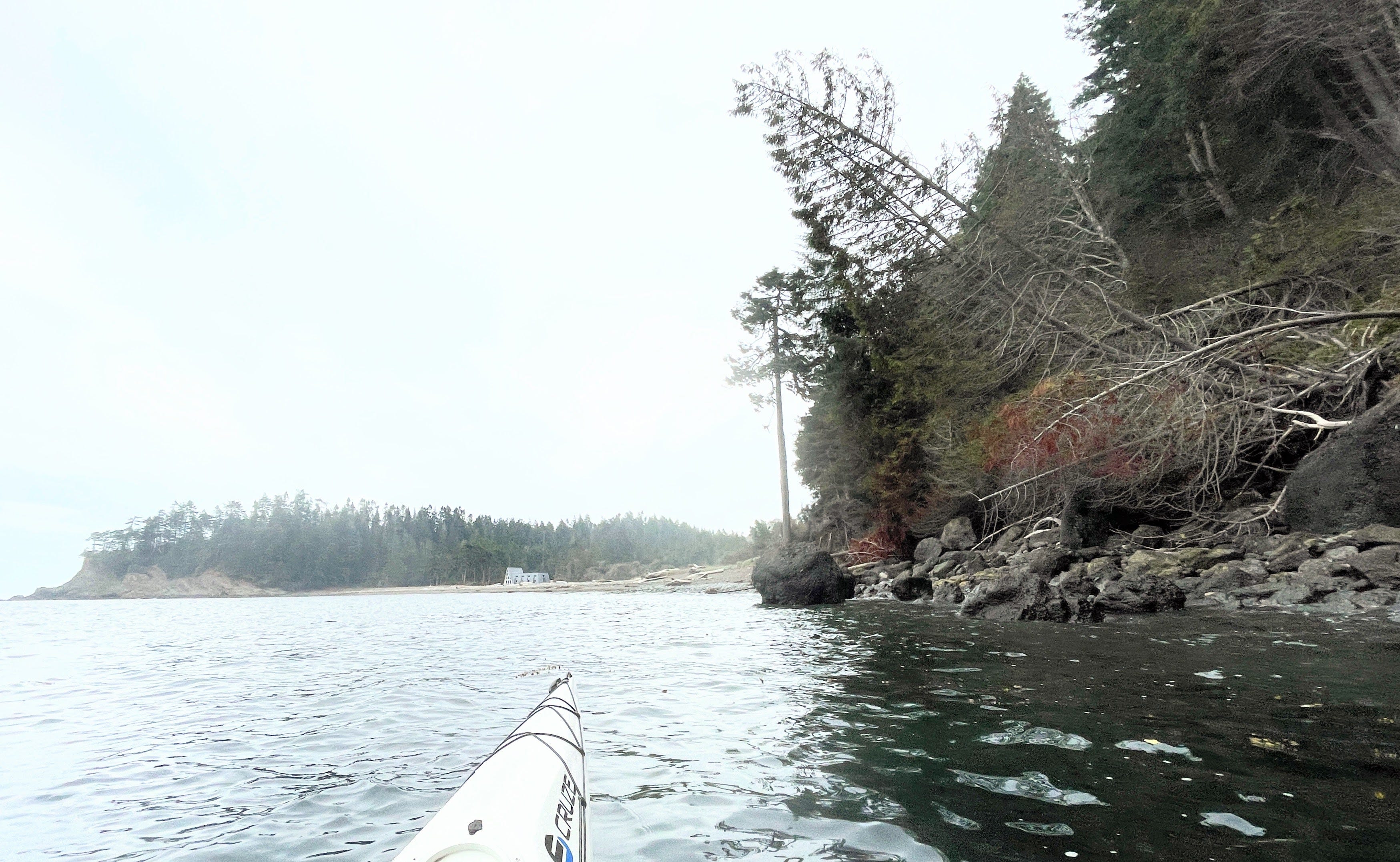
Bordering the west side of Crescent Beach on the Olympic Peninsula is Agate Rock (formerly Clam Point). The ‘rock’ is a tree topped medium bluff point or headland surrounded by thick bull kelp beds.
A historically rich area, the Klallam or S’Klallam people had a village in Crescent Bay titled k̕ʷaʔšə́nəm since time immemorial with abundant resources from the coastline and Salt Creek which flowed throughout the year.
In 1865, Crescent Bay was inhabited by three former Hudson Bay trappers and their families.

On the west side of Agate Rock is Agate Beach which was once open to the public but later privatized. Per the name, agates were plentiful. The ‘rock’ and the beach have been off limits for years, yet still enjoyable to view from off shore.
Recently, the folks who own the ‘rock’ and beach have recently opened up this beach house there for events and rentals.
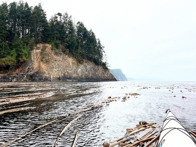
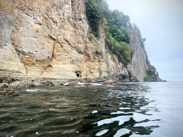
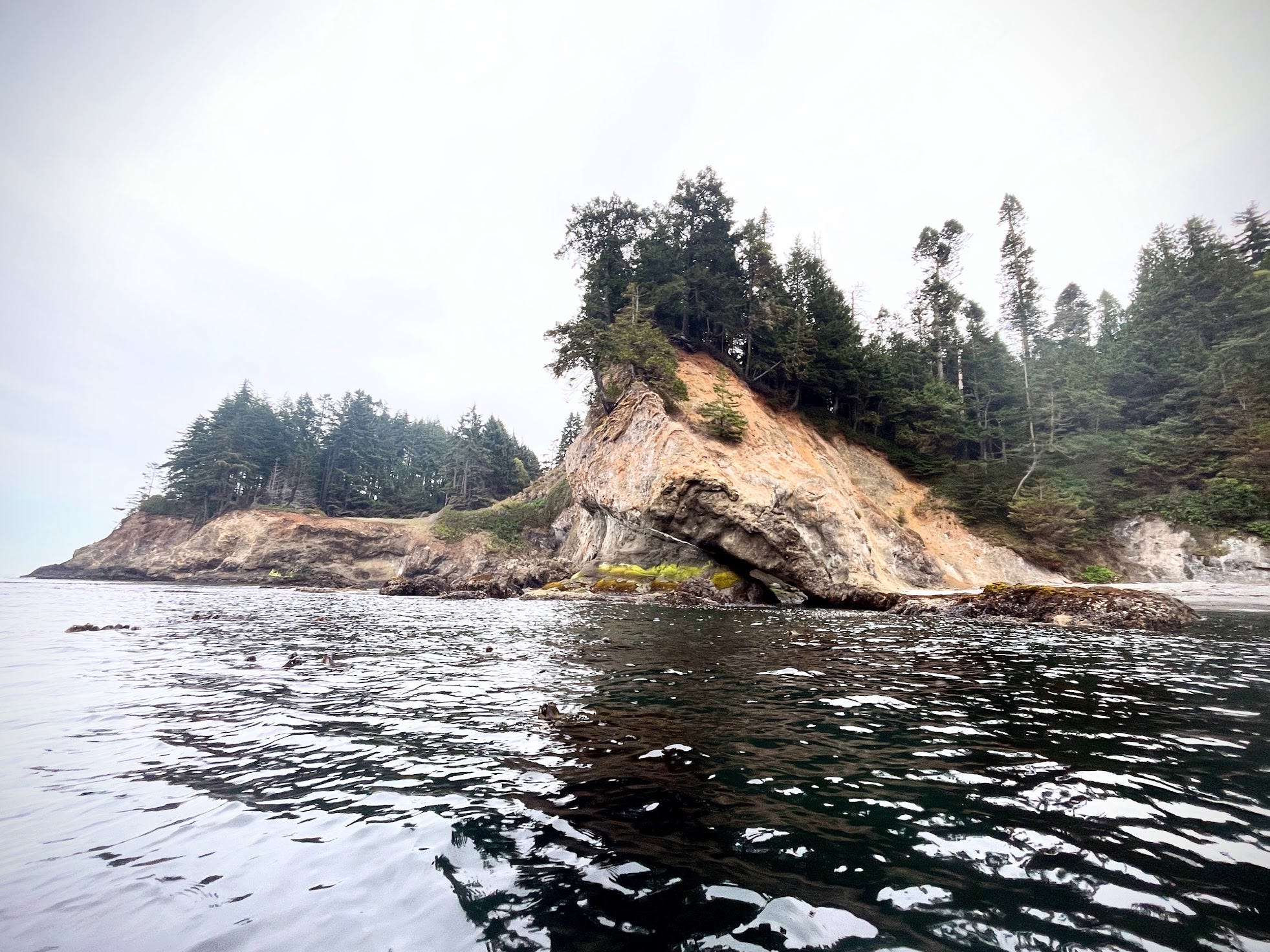
Slightly west of the beach is a massive cliff that rises up several hundred feet. Below the cliff along the shore are a bunch of rounded rocks and on a barnacled shelf, an oddly placed door leading to a possible 19th century mine. Read more about the door in the cliff on my other SubStack page Paddling the Salish Sea.
Little is known about the mine. A friend told me about it years ago and said it had a door at that time. Another person on the Facebook group The History and Memories of the Olympic Peninsula said it was probably a manganese mine. Otherwise I can’t find any images of it during operation.
The only access here is by boat or human powered water craft. I’ve paddled there a few times but could never land due to heavy seas bashing against the rock shelf and cliff. Note: Paddling here requires expert skills due to it’s remoteness, ocean swell, wind, rocky private shores and kelp beds which grab fins/rudders.
Viewing the seemingly remote rugged shoreline and rock cliffs with eagles swirling above you wouldn’t think anyone has been there, but in the 1880’s the town of Port Crescent in Crescent Bay was a thriving logging establishment and port hosting a hotel, post office, housing and railroad.
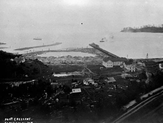
Every time I come across the following images from the Burt Kellogg Collection at North Olympic Heritage, I want to learn more. Was the mine there then? Who are these folks?
I show this image juxtaposition in my Paddling the Salish Sea book presentations for Trip #46. I paddled the spot last summer and tried to match up the rounded rocks as much as possible but couldn’t get too close due to a strong westerly wind and waves pushing me towards shore. And I think the shore is private property.
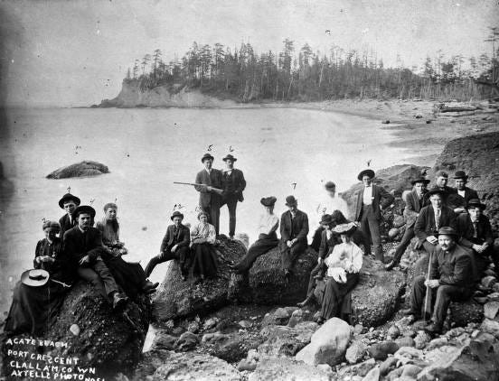
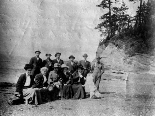
Axtell Photo Group of people sitting and standing on rocks on beach. One man is holding rifle; one woman is holding a baby. Beach in background on right; point of land in distance. Summer 1903. Note: inscription reads, "Agate Beach, Port Crescent, Clallam Co., Wn, Axtells photo No. 51" (NOLS)
These two are closer to Agate Rock, I believe on the north end of the beach touching the embankment in the below Now image. Both unknown photographer and year.
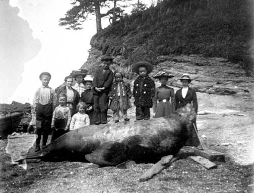
I’m assuming this sea lion pretty smelled a bit.
Related Posts & Resources:
Crescent Bay, A Historical Overview / Paddling the Salish Sea
The Search for a Door in the Cliff / Paddling the Salish Sea
North Olympic Heritage (NOLS) - NOLS offers history talks worth checking out.
Trip #46 in my book Paddling the Salish Sea 80 Trips from Mountaineers Books
Use ONX Maps to check for property lines